
Explore accurate tide charts and tables for
Virginia fishing, shellfishing, boating and beach outings.
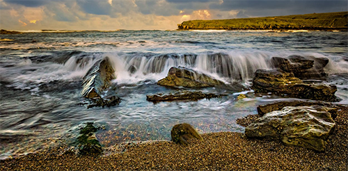
Stations and tide pools are covered in the map.
Popular: Cape Charles • Chesapeake Bay Bridge • Chesapeake Beach • Fishermans Island • Hampton • Kiptopeke Beach • Money Point • Newport News • Norfolk • Portsmouth • Rudee Inlet Bridge • Virginia Beach
Virginia Tide Stations
Back River: Messick Point
Bogues Bay: Wishart Point
Chesapeake Bay: Cape Charles • Chesconessex Creek • Fishermans Island • Fleeton • Great Wicomico River Light • Guard Shore • Kiptopeke Beach • Little Creek Beach • Muddy Creek Entrance • Old Plantation Light • Onancock • Tangier • Watts Island • West Branch Lynnhaven River • Windmill Point Light • Wolf Trap Light
Chickahominy River: Ferry Point bridge • Wright Island Landing
Chincoteague Island: Blake Cove • Chincoteague • Lewis Creek • Oyster Bay • South Chincoteague
Church Point: Jamestown Island
Coles Neck: Ragged Point
Corrotoman River: Millenbeck
Elizabeth River: Craney Island • Deep Creek entrance • Money Point • Norfolk • Portsmouth
Great Wicomico River: Glebe Point
Hampton Roads: Hampton • Sewells Point
Inside: Great Machipongo Inlet
James River: Burwell Bay • Charles City • Chesterfield Power Station • Claremont • Fort Eustis • Haxall • Hopewell • Huntington Park • Jordan Point • Kingsmill • Meadowville • Menchville • Newport News • Richmond River Locks • Scotland • Smithfield, Pagan River • Sturgeon Point
Lynnhaven Bay: Broad Bay Canal • Brown Cove • Buchanan Creek entrance • Chesapeake Beach • Long Creek
Mattaponi River: Fraziers Ferry
McKans Bay: Rappahannock River
Metompkin Inlet: Metompkin Inlet • Folly Creek • Metompkin Inlet
Mobjack Bay: Mobjack Bay • Browns Bay • Mobjack Bay
Nansemond River: Hollidays Point • Pig Point • Town Point
Nomini Creek: Mount Holly
North River: Mobjack Bay
Occohannock Creek: Gaskins Point
Pamunkey River: Lester Manor • Northbury
Piankatank River: Deltaville • Piankatank River Bridge
Potomac River: Alexandria • Aquia Creek • Colonial Beach • Lewisetta • Lewisetta • Mathias Point • Quantico
Pungoteague Creek: Harborton
Rappahannock River: Hopyard Landing • Massaponax • Port Royal • Rappahannock Bend • Saunders Wharf • Tappahannock • Urbanna • Wake Beach • Wares Wharf • Westland
Revel Island Bay: Revel Island
Rudee Inlet: Lake Rudee • Lake Wesley • Rudee Inlet Jetty
Starling Creek: Saxis
Sunnybank: Little Wicomico
Toms Cove: Chincoteague Island
Upper Machodoc Creek: Dahlgren
USCG: Sand Shoal Inlet
Wachapreague Channel: Wachapreague
Yeocomico River: Kinsale
York River: Cheatham Annex • Gloucester Point Beach • Goodwin Neck • Roane Point • Tue Marshes Light • West Point • Yorktown USCG
Best Tide Pools in Virginia
Virginia’s coastline offers unique tidepooling opportunities. Below are some top spots known for their marine life. Tidepools are marked on the Map tab above in red. The titles below are linked to the tide page that supports that locations tide pool charts.
False Cape State Park - False Cape State Park, one of Virginia's most primitive and remote coastal parks, offers pristine barrier island beaches with expansive tidal flats and shallow pools at low tide along Back Bay and the Atlantic. Discover fiddler crabs, periwinkles, hermit crabs, small fish, and shorebirds foraging in the unspoiled intertidal zones. Access via hiking, biking, or tram through Back Bay National Wildlife Refuge - no vehicles allowed, making it a true wilderness adventure perfect for nature lovers seeking solitude and authentic Lowcountry exploration.
First Landing State Park - First Landing State Park in Virginia Beach, where English colonists first landed in 1607, features calm Chesapeake Bay shores with rocky outcrops and sandy flats exposing small tide pools at low tide, alive with barnacles, mussels, shore crabs, periwinkles, and occasional small fish. Trails through cypress swamps and maritime forest add to the historic and natural appeal - family-friendly with camping, boating, and educational programs for gentle intertidal discovery.
Kiptopeke State Park - Kiptopeke State Park on the Eastern Shore boasts concrete ship breakwaters from WWII creating protected lagoons and rocky areas that reveal interesting tide pools at low tide, teeming with mussels, barnacles, green crabs, small fish, and algae in the calm waters of the Chesapeake Bay. Birdwatching is exceptional along the flyway - amenities include fishing piers, camping, and launch ramps, making it ideal for relaxed family outings and marine observation.