Explore accurate tide charts and tables for
South Carolina fishing, shellfishing, boating and beach outings.
Stations and tide pools are covered in the map.
Popular: Beaufort SC • Ben Sawyer Bridge • Cherry Grove Beach • Edisto Beach • Folly Beach • Garden City • Georgetown • Hilton Head • Huntington Beach • Isle of Palms • Kiawah Island • Murrells Inlet • Myrtle Beach • Pawleys Island • Pawleys Island ICW • Sullivans Island
South Carolina Tide Stations
Ashepoo River: Airy Hall Plantation • Ashepoo • Bluff Islands • Brickyard Ferry • Hutchinson Island • Mosquito Creek • Seabrook
Ashley River: Bacon Bridge • Bee's Ferry • Cosgrove Bridge • Duck Island • Greggs Landing • I-526 bridge • James Island Creek • Magnolia Gardens • South Ashley Bridge • Wappoo Creek bridge
Atlantic Ocean: Cherry Grove Beach • Folly Beach
Big Bay Creek: Carters Dock
Black Mingo Creek: Rhems
Black River: Mt. Pleasant Plantation • Windsor Plantation • Winea Plantation
Bohicket Creek: Ho-Non-Wah • Oak Branch • Rockville
Broad River: Euhaw Creek • Hall Island • Hazzard Creek • Hwy 170 bridge • I-95 bridge • North Dawson Landing • West Branch Boyds Creek • Whale Branch
Bull Creek: Savage Island
Bull River: Summerhouse Point
Bulls Bay: Awendaw Creek • Boneyard Beach • Five Fathom Creek • Harbor River • Jeremy Creek • Wharf Creek
Charleston Harbor: Breach Inlet • Capers Island • Folly River • Hamlin Creek • Isle of Palms • North Capers Island • North Dewees Island
Chechessee River: Chechessee Creek
Chehaw River: Wiggins
Colleton River: Callawassie Creek • Callawassie Island Bridge • Entrance • Okatee River • S Callawassie Island
Combahee River: Bluff Plantation • Cuckolds Creek • Fields Point • US 17 Bridge
Cooper River: Blessing Plantation • Bonneau Ferry • Bull Creek • Charleston • Clouter Creek North entrance • Clouter Creek South entrance • Dupont • General Dynamics Pier • Goose Creek entrance • Haig Point • Hanahan • Old Rice Mill • Pimlico • Pine Island • Quinby Creek • Richmond Plantation • Snow Point
Coosaw River: Briars Creek Entrance • Brickyard Point • Lobeco • Lucy Point Creek • Whale Branch entrance
Crab Haul Creek: Oyster Landing
Dawho River: Dawho • Dawho Bridge
Dewees Inlet: South Dewees Island
Dunn Sound: Little River Inlet • Little River Town
Folly River: Folly Island
Goose Creek: Yeamans Hall
Grand Strand: Allston Creek • Arcadian Shores • Captain Alex's Marina • Combination Bridge • Garden City Bridge • Huntington Beach • Murrells Inlet • Oaks Creek • Pawleys Island • Pawleys Island Inlet • Pawleys Island South
Great Pee Dee River: Arundel Plantation • Carr Creek • Holly Grove Plantation • Lower Topsaw Landing • South of Sam Worth • Weymouth Plantation • Yauhannah Bridge
House Creek: Cherry Grove Inside
Hwy 171 Bridge: Folly Creek
ICW: Ashepoo River • Ben Sawyer Bridge • Casino Creek • Moores Landing • South Island Ferry
Little River: Little River Town • Neck
Long Bay: Litchfield by the Sea • Pawleys Island ICW
Lowcountry: Albergottie Creek • Battery Creek • Beaufort SC • Brickyard Creek MCAS • Calibogue Cay • Capers Creek • Cowen Creek • Cowen Creek bridge • Distant Island • Fort Fremont • Kiawah Island • Port Royal Plantation • Skull Creek North • Skull Creek South • South Beach
Mackay Creek: Pinckney Island
May River: Bluffton • Bull Island North • Moreland Cemetery
Morgan River: Edding Point • Jenkins Creek • Lucy Point Creek entrance • Village Creek • Village Creek
Murrells Inlet: Garden City
New River: Bloody Point • Cook Landing Cemetery • Daufuskie Island • Doughboy Island • Good Hope Landing • Hargray Pier • Rt. 170 bridge
North Edisto River: Leadenwah Creek • Point of Pines • Toogoodoo Creek • Toogoodoo Creek
North Inlet: Clambank Creek
North Santee Bay: Cedar Island
Polawana Island: Jenkins Creek
Port Royal Sound: Station Creek
Russel Creek: Windsor Plantation
Salt Water Creek, Wright River
Sampit River: Cumberland • Georgetown • Jacobs Wharf
Santee River: Brown Island • Cedar Island Point • Jamestown Bridge • Minim Creek Entrance • North Santee Bridge • North Santee River Inlet • Pleasant Hill Landing • US 17 Bridge
Savannah River: Little Back River • Purrysburg Landing
South Edisto River: Canaday Landing • Edisto Beach • Edisto Marina • Fenwick Island • Hope Creek • Jacksonboro Camp • Ocella Creek • Penny Creek • Pine Landing • Willtown Bluff
St. Helena Sound: Harbor Island Beach • Hunting Island Bridge • Johnson Creek Bridge • Otter Island
St. Pierre Creek: Peters Point
Steamboat Creek: Steamboat Landing
Stono River: Abbapoola Creek entrance • Church Flats • Elliott Cut entrance • Limehouse Bridge • Pennys Creek • Pennys Creek • Snake Island
Sullivans Island: Sullivans Island • The Cove
Tom Point Creek: Park Island
Trenchards Inlet: Capers Island • Club Bridge Creek entrance
Waccamaw River: Bucksport • Bull Creek entrance • Conway, RR. bridge • Enterprise Landing • Grahamville • Hagley Landing • Keysfield • Little Bull Creek entrance • Pitch Landing • Thoroughfare Creek • Wachesaw Landing
Wadmalaw River: Bluff Point • Church Creek Bridge • Johns Island • Yonges Island
Wando River: Cainhoy • Hobcaw Point • Nowell Creek • Parker Island • Rathall Creek • SE Paradise Island • Woodville
West Branch, Cooper River: Back River Reservoir
West End: Dunn Sound
Whale Branch: Sheldon
Winyah Bay: Black River • South Island USCG • Winyah Bay Entrance
Wright River: Fields Cut
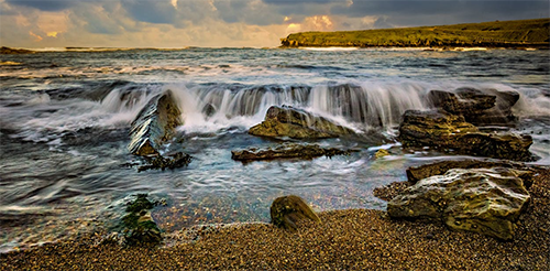
Best Tide Pools in South Carolina
South Carolina’s coastline offers unique tidepooling opportunities. Below are some top spots known for their marine life. Tidepools are marked on the Map tab above in red. The titles below are linked to the tide page that supports that locations tide pool charts.
Burkes Beach (Hilton Head Island) - Burkes Beach on Hilton Head Island is a family favorite for gentle tidepooling along its wide, soft sandy flats. At low tide, shallow pools emerge teeming with fiddler crabs, hermit crabs, snails, small fish, and occasional shells in calm, clear waters. The relaxed atmosphere and easy access make it safe and enjoyable for young children to wade and explore, combine with biking the island paths or shell collecting for a perfect low key beach day.
Edisto Beach State Park - Edisto Beach State Park preserves an undeveloped shoreline with rocky outcrops and marsh edges that reveal rich tide pools at low tide, alive with periwinkles, fiddler crabs, mussels, anemones, and small marine invertebrates. Trails wind through maritime forest, and the nature center offers educational insights, ideal for families seeking an immersive, unspoiled Lowcountry experience. Wear sturdy shoes for uneven terrain and visit during negative tides.
Folly Beach County Park - Folly Beach County Park at the west end of Folly Island features protective jetties and rocky areas forming calm tide pools at low tide, brimming with mussels, barnacles, shore crabs, small fish, and seaweed. Amenities include parking, restrooms, and lifeguards making it a convenient, family friendly spot to combine tidepooling with picnics, swimming, or watching surfers nearby.
Fripp Island - Fripp Island's gated resort beaches provide secluded rocky outcrops and jetties exposing pristine tide pools at low tide with crabs, small tropical fish, hermit crabs, and excellent shelling opportunities. The quiet, natural setting away from crowds is perfect for peaceful family discovery, access requires a resort stay or day pass; pair with golf or wildlife viewing.
Hunting Island State Park - Hunting Island State Park boasts dramatic boneyard beaches and eroded rocky zones where low tides uncover fascinating pools filled with fiddler crabs, barnacles, snails, mussels, and small fish amid driftwood sculptures. Climb the historic lighthouse for views and visit the nature center for exhibits, a wildly beautiful, educational spot for all ages, watch for strong currents.
Huntington Beach State Park - Huntington Beach State Park near Murrells Inlet features jetties and a natural sandy, rocky shoreline forming shallow tide pools at low tide with crabs, mussels, small fish, and foraging shorebirds. Boardwalks lead to Atalaya Castle and trails through marshes, family oriented with camping and picnic areas for a full day of relaxed coastal exploration.
Isle of Palms - Isle of Palms County Park and adjacent beaches create expansive, gentle shallow pools at low tide along the wide shoreline, ideal for young kids to safely spot small crabs, fish, hermit crabs, and shells in warm waters. Front Beach amenities and calm waves enhance the family friendly vibe, great near Charleston for easy access and combining with playgrounds.
Kiawah Island - Kiawah Islands pristine private beaches and marsh fringes reveal calm tidal pools at low tide, hosting hermit crabs, periwinkles, fiddler crabs, small fish, and diverse shells in a luxurious, natural setting. Uncrowded and serene, perfect for resort guests or day visitors seeking high end family tidepooling with opportunities for biking or golf nearby.
Myrtle Beach (Cherry Grove) - Cherry Grove in North Myrtle Beach offers wide, sloping beaches where low tides form large temporary pools along the shore, filled with small crabs, fish, snails, and shells in warm, shallow water. The lively yet family oriented area includes piers and amusements nearby, excellent for safe wading and discovery in the Grand Strand's northern end.
Myrtle Beach State Park - Myrtle Beach State Parks scenic pier and natural shoreline expose intertidal zones and shallow pools at low tide, rich with crabs, mussels, small fish, anemones, and shorebirds. Shaded picnic areas, playgrounds, and camping facilities abound, a peaceful oasis amid the bustle, perfect for families wanting structured amenities with authentic coastal exploration.
Sullivans Island - Sullivans Island near the Charleston Lighthouse features jetties and rocky pockets that uncover temporary tide pools at low tide with shore crabs, small fish, barnacles, and marine invertebrates. The historic, residential beachfront offers a charming, low key atmosphere, great for families combining exploration with lighthouse views and quiet walks.