
Explore accurate tide charts and tables for
Massachusetts fishing, shellfishing, boating and beach outings.
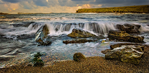
Stations and tide pools are covered in the map.
Popular: Boston • Chatham • Edgartown • Falmouth • Gloucester • Hyannis Port • Marion • Nantucket • Newburyport • Plymouth • Salem • Scituate • Wellfleet • Woods Hole
Massachusetts Tide Stations
Atlantic Ocean: Aquinnah • Chatham • Great Point • Muskeget Island • Nomans Land • Squibnocket Point
Boston Harbor: Boston • Charlestown • Chelsea • Deer Island South • Moon Head • Mystic River • Neponset River • Nut Island
Buzzards Bay: Cuttyhunk • Fort Rodman • Gray Gables Beach • Great Hill • Little Harbor • Marion • Mattapoisett • Monument Beach • Nashawena Island • New Bedford • Onset • Penikese Island • Plum Island • Round Hill Point • Uncatena Island South • Westport Point • Wings Cove • Woods Hole
Cape Cod Bay: Duxbury MA • Plymouth • Sandy Neck Colony • Sesuit Harbor • Wellfleet
Cape Cod Canal: Bourne Bridge • Bournedale • Buzzards Bay • Cape Cod Canal East • Sagamore
Georges Bank: Texas Tower
Gloucester Harbor: Gloucester
Hingham Harbor: Crow Point
Ipswitch Bay: Annisquam
Little Brewster Island: Boston Light
Lobster Cove: Annisquam
Massachusetts Bay: Green Harbor • Hingham • Hull Bay • Lynn Beach • Minot • Nantasket Beach • Rockport • Salem • Scituate • Weymouth Fore River Bridge
Merrimack River: Merrimacport • Newburyport • Plum Island Beach • Riverside • Salisbury Point
Mount Hope Bay: Fall River, MA
Nantucket Sound: Bass River • Cotuit Highlands • Dennisport • Edgartown • Eel Point • Falmouth • Hyannis Port • Nantucket • Oak Bluffs • Pleasant Bay • Poponesset • Saquatucket Harbor • Stage Harbor • Wychmere Harbor
North River: Damons Point
Vineyard Sound: Cedar Tree Neck
Westport River: Hix Bridge
Best Tide Pools in Massachusetts
Massachusetts’s coastline offers unique tidepooling opportunities. Below are some top spots known for their marine life. Tidepools are marked on the Map tab above in red. The titles below are linked to the tide page that supports that locations tide pool charts.
Breakwater Beach - Breakwater Beach in Brewster on Cape Cod Bay is famous for its expansive tidal flats and abundant tide pools at low tide, where families can find hermit crabs, snails, small fish, and occasional sea stars in the warm, shallow waters. The dramatic low-tide exposure allows walking far out on the flats, making it an adventurous and educational spot for all ages. Pair with nearby Brewster beaches for a full day of bayside exploration.
Cape Cod National Seashore - Stretching along the Outer Cape from Eastham to Provincetown (about 2 hours from Boston in Cape Cod National Seashore), this 40-mile protected coastline features scattered rocky outcrops and headlands that expose modest but rewarding tide pools at low tide, especially near Coast Guard Beach, Nauset Light, or Race Point. Families can spot shore crabs, periwinkles, barnacles, mussels, small fish like sculpins, occasional sea stars, and anemones amid dunes and dramatic waves. Highly family-friendly with ranger-led programs, trails, lighthouses, and visitor centers; one of New England's iconic natural areas for safe, educational exploration. Entry fee; minus tides for best viewing - combine with biking or whale watching for a full day.
Chapin Memorial Beach - Chapin Memorial Beach in Dennis on Cape Cod Bay offers extensive tidal flats that form numerous shallow pools at low tide, perfect for spotting hermit crabs, sand dollars, sea stars, and tiny fish. With its long stretch of soft sand and calm waters, this beach is great for families seeking safe, engaging intertidal adventures. Time your visit for minus tides to explore the farthest reaches.
Coffins Beach - Coffins Beach in Gloucester stretches along a barrier system with rocky sections that reveal intriguing tide pools at low tide, home to green crabs, periwinkles, mussels, barnacles, and occasional sea stars. This less-crowded alternative to nearby beaches offers wide sandy expanses transitioning to rocky intertidal zones perfect for exploration. With views of Crane Beach across the water and opportunities for birdwatching, it is a peaceful spot for families to discover North Shore marine life - check tides and park at Wingaersheek for access.
Corporation Beach - Corporation Beach in Dennis on Cape Cod Bay reveals wide tidal flats and warm shallow pools at low tide, alive with hermit crabs, moon snails, small fish, and razor clams. This crescent-shaped family beach with soft sand and gentle slopes is perfect for young explorers wading through the exposed seafloor. Amenities include snacks and restrooms - ideal during negative tides for maximum flats exposure.
Cranes Beach - Cranes Beach in Ipswich, part of a Trustees reservation, features expansive dunes and a long sandy shore with rocky sections and boardwalks leading to tide pools rich in hermit crabs, sand dollars, periwinkles, and shorebirds. The vast barrier beach and adjacent salt marshes create a pristine habitat for intertidal life visible at low tide. Combine exploration with hiking the dune trails - parking fees apply; highly recommended for nature lovers.
Good Harbor Beach - In Gloucester north of Boston (about 1 hour drive), Good Harbor Beach's northern rocky end and adjacent areas reveal small but accessible tide pools at low tide with mussels, periwinkles, barnacles, shore crabs, limpets, and occasional small anemones in sheltered pockets. A classic family beach with white sand, lifeguards, boardwalks, and facilities; the calm waters and easy access make it ideal for kids to safely explore intertidal life while enjoying swimming or picnics - arrive early during minus tides to beat crowds.
Halibut Point State Park - In Rockport north of Boston (about 1 hour drive in Halibut Point State Park), the dramatic granite quarry ledges and rocky shoreline create fascinating tide pools at low tide brimming with purple sea stars, green anemones, urchins, chitons, limpets, barnacles, hermit crabs, periwinkles, and small fish darting in crevices. Family-friendly with trails through the old quarry, picnic areas, tower views, and interpretive signs; a scenic spot blending geology and marine life - free parking; best during minus tides with sturdy shoes for uneven rocks.
Mayflower Beach - Mayflower Beach in Dennis on Cape Cod Bay features wide, gentle tidal flats that reveal inviting shallow pools at low tide, teeming with hermit crabs, periwinkles, sand dollars, sea stars, and small marine creatures. Known for its warm waters and soft sand, this highly rated beach is exceptionally kid-friendly with plenty of space for safe exploration and play. Combine tide pooling with picnicking or watching stunning bayside sunsets for a classic Cape Cod experience.
Nahant Beach (40 Steps Beach) - The rocky areas at Nahant Beach Reservation, particularly around 40 Steps Beach, expose excellent tide pools during low tide filled with hermit crabs, snails, small anemones, shore crabs, and seaweed-covered rocks. This accessible North Shore spot near Boston combines long sandy beaches with fascinating intertidal zones ideal for close-up observation. Wear sturdy shoes for slippery rocks and time your visit for minus tides to uncover the richest pools.
Paines Creek Beach - Paines Creek Beach in Brewster reveals impressive tidal flats and pools at low tide, alive with hermit crabs, periwinkles, moon snails, and small marine life amid the vast exposed seafloor. This scenic spot is particularly noted for breathtaking sunsets over Cape Cod Bay, with a gentle creek adding to the charm. Ideal for relaxed tide pooling and photography - check tides to catch the flats at their widest.
Plum Island - On Plum Island near Newburyport north of Boston (about 1 hour drive within Parker River National Wildlife Refuge), the barrier island's sandy beaches and minor rocky patches near the refuge expose small tide pools and flats at low tide hosting barnacles, periwinkles, shore crabs, mussels, and excellent birdwatching opportunities. Family-friendly with boardwalks, observation towers, trails, and refuge visitor center; a peaceful natural area for kids to discover intertidal creatures amid dunes and marshes - entry fee; minus tides for pools; great for combining with wildlife viewing.
Red Rock Park - Red Rock Park in Lynn features a scenic rocky shoreline with colorful tide pools teeming with green crabs, periwinkles, barnacles, mussels, and small fish in protected pockets. Part of the Lynn Shore Reservation, this convenient spot close to Boston offers pathways, benches, and ocean views alongside easy access to intertidal exploration. Great for quick family outings - low tide reveals the best marine discoveries.
Sandy Point State Reservation - Sandy Point State Reservation at the southern end of Plum Island in Ipswich offers serene rocky and sandy areas exposing tide pools rich with green crabs, periwinkles, sea stars, sand dollars, and shorebirds foraging nearby. Part of a protected wildlife refuge, this tranquil spot provides pristine natural beauty and excellent opportunities to observe intertidal life in a calm, uncrowded setting. Best visited at low tide - arrive early for parking.
Singing Beach - Singing Beach in Manchester-by-the-Sea boasts quartz sand that "sings" underfoot and rocky ends exposing tide pools at low tide with crabs, snails, limpets, and occasional urchins. This picturesque half-mile crescent beach with cliffs and clear water provides a charming setting for tidepooling away from larger crowds. Resident parking restrictions apply in summer - arrive early or walk from town.
Skaket Beach - Skaket Beach in Orleans on Cape Cod Bay is renowned for its vast tidal flats that extend nearly a mile out at low tide, creating countless warm, shallow pools ideal for exploration. Discover hermit crabs, sea stars, moon snails, razor clams, small fish, and sand dollars in the sandy depressions. This family-friendly beach offers spectacular sunsets as the tide returns, making it a perfect spot for gentle wading and marine discovery. Plan your visit around negative tides for the most expansive exposure.
Wingaersheek Beach - In Gloucester north of Boston (about 1 hour drive), Wingaersheek Beach's western rocky shoreline and granite outcrops form sheltered tide pools at low tide featuring aggregating anemones, limpets, mussels, barnacles, shore crabs, periwinkles, and small marine life in calm, clear waters. Extremely family-friendly with soft sand, shallow swimming areas, lifeguards, facilities, and stunning views; one of the North Shore's top spots for kids to safely explore pools while playing on the beach - arrive early during minus tides for best exposure and parking.