
Explore accurate tide charts and tables for
Rhode Island fishing, shellfishing, boating and beach outings.
Stations and tide pools are covered in the map.
Popular: Beavertail State Park • Bristol • Martha's Vineyard • Narragansett Pier • Newport • Point Judith • Providence • Prudence Island • Quonset Point • Watch Hill Beach • Wickford
Rhode Island Tide Stations
Bay Oil Pier: North End
Block Island Sound: Block Island Southwest • New Shoreham • Weekapaug
Bristol Harbor: Bristol
Conanicut Island: Conanicut Point • Jamestown
Harbor of Refuge: Point Judith
Jamestown: Beavertail State Park
Narragansett Bay: Bristol Ferry • Bristol Highlands • Castle Hill • Conimicut Light • East Greenwich • Narragansett • Narragansett Pier • Newport • Providence • Prudence Island • Seekonk River • Wickford
North Kingstown: Quonset Point
Pawcatuck River: Westerly
Pawtuxet River: Pawtuxet Cove
Providence River: Bullock Cove
Sachuest River: Flint Point
Sakonnet River: Anthony Point • Fogland Beach • Nannaquaket Neck • Sakonnet
Seekonk River: Pawtucket
Taunton River: Steep Brook
Watch Hill Passage: Watch Hill Beach
Best Tide Pools in Rhode Island
Rhode Island’s coastline offers unique tidepooling opportunities. Below are some top spots known for their marine life. Tidepools are marked on the Map tab above in red. The titles below are linked to the tide page that supports that locations tide pool charts.
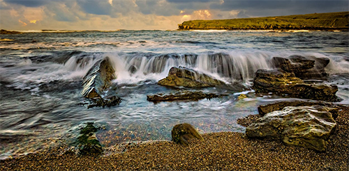
Beavertail State Park - Beavertail State Park in Jamestown is Rhode Island's premier tidepooling destination. Its dramatic rocky coastline exposes rich intertidal zones at low tide, teeming with colorful sea stars, green anemones, periwinkles, crabs, and small fish. The iconic lighthouse and open ocean views make it perfect for families - easy parking, trails, and interpretive signs help kids learn while exploring safely. One of the best spots in New England for classic rocky tidepools.
Black Point - Black Point in Narragansett offers excellent rocky tidepooling along its scenic coastal trail. Low tides reveal pools filled with barnacles, mussels, crabs, sea stars, and small sculpins. The moderate hike adds adventure, but the pools are accessible and rewarding - great for families who enjoy a short walk to quieter, natural areas with stunning ocean views.
Brenton Point State Park - Brenton Point State Park in Newport features dramatic open-ocean rocky shoreline where low tides expose fascinating pools teeming with sea stars, anemones, crabs, and small sculpins. Wide open spaces for kite flying and picnics, plus stunning views of the Atlantic - ideal for families wanting adventure with room to roam.
Charlestown Breachway - Charlestown Breachway's rocky inlet and surrounding shoreline create dynamic pools at low tide with mussels, crabs, barnacles, and small fish. The breachway is popular for fishing, and nearby Ninigret Pond adds variety - family-friendly with parking and easy access for a mix of tidepooling and beach activities.
East Matunuck State Beach - East Matunuck State Beach in South Kingstown features rocky sections and jetties that form shallow, safe pools at low tide - perfect for young children to explore crabs, periwinkles, and small fish. Wide sandy beach, lifeguards, and facilities make it one of the most family-oriented tidepool spots on Rhode Island's south shore.
Fort Adams State Park - Fort Adams State Park in Newport features rocky shoreline near the historic fort where low tides create fascinating pools with mussels, periwinkles, crabs, and occasional sea stars. Family-friendly with picnic areas, sailing events, and the fort's tours - combine tidepooling with history for an educational day out. Calm waters in the bay make it safe for younger explorers.
Narragansett Town Beach / Scarborough State Beach - Narragansett Town Beach and adjacent Scarborough State Beach offer some of Rhode Island's most accessible tidepooling. Rocky jetties and outcrops at both ends of the beach create protected pools at low tide filled with green crabs, periwinkles, small fish, mussels, and barnacles. Extremely family-friendly with lifeguards, restrooms, parking, and concessions - perfect for combining tidepooling with a full beach day.
Rome Point / Napatree Point - Rome Point in North Kingstown and nearby Napatree Point offer quieter, more natural tidepooling along protected rocky shores in Narragansett Bay. Pools host crabs, snails, mussels, and occasional sea stars. Short hikes add exploration - great for families seeking peaceful, less-crowded spots with excellent wildlife viewing.
Sachuest Point National Wildlife Refuge - Sachuest Point National Wildlife Refuge in Middletown boasts one of Rhode Island's richest rocky intertidal zones. Low tides reveal diverse pools with sea stars, anemones, periwinkles, hermit crabs, and small fish. Easy walking trails, birdwatching, and interpretive signs make it exceptionally educational and family-oriented - a hidden gem for nature lovers.