
Explore accurate tide charts and tables for
Connecticut fishing, shellfishing, boating and beach outings.
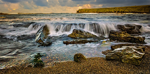
Stations and tide pools are covered in the map.
Popular: Bridgeport • Guilford Harbor • New Haven • New London • South Norwalk • Stamford
Connecticut Tide Stations
Branford River: Branford
Bridgeport Harbor: Bridgeport
Connecticut River: Essex CT • Haddam • Hadlyme • Hartford • Higganum Creek • Lyme • Maromas • Middletown • Rocky Hill • Saybrook Jetty • Saybrook Point • South Hartford • Tylerville
Fivemile River: Rowayton
Housatonic River: Long Hill • Shelton • Sniffens Point • Stratford
New Haven Harbor: Lighthouse Point • New Haven
Niantic River: Niantic
Pilots Point Marina: Safe Harbor
Thames River: New London • Norwich • Yale Boathouse
Best Tide Pools in Connecticut
Connecticut’s coastline offers unique tidepooling opportunities. Below are some top spots known for their marine life. Tidepools are marked on the Map tab above in red. The titles below are linked to the tide page that supports that locations tide pool charts.
Bluff Point State Park - In Groton along Long Island Sound, Bluff Point State Park and Coastal Reserve preserves one of Connecticut's finest undeveloped coastal areas with extensive rocky shorelines and tidal zones that reveal small but rewarding tide pools at low tide. Families can explore for shore crabs, barnacles, periwinkles, mussels, snails, small fish, and occasional anemones in a serene, natural setting - perfect for hiking, biking, and birdwatching alongside discovery. Free entry with ample parking and miles of trails; a peaceful escape ideal for all ages seeking quiet intertidal exploration. Sturdy shoes recommended for uneven terrain.
Hammonasset Beach State Park - In Madison - the largest public beach in Connecticut - Hammonasset Beach State Park features a two-mile shoreline with rocky outcrops, jetties, and tidal areas that expose accessible tide pools at low tide. Spot crabs, barnacles, periwinkles, mussels, small invertebrates, and occasional horseshoe crabs; greatly enhanced by the Meigs Point Nature Center's touch tanks, exhibits, and educational programs. Extremely family-friendly with boardwalks, camping, picnic areas, concessions, and lifeguards - making it a classic spot for combining beach fun with gentle, educational tidepooling on Long Island Sound.
Meigs Point (Hammonasset) - At the eastern end of Hammonasset Beach State Park in Madison, Meigs Point offers calmer rocky areas and tidal pools with educational support from the on-site Nature Center (touch tanks and exhibits). Spot crabs, barnacles, small fish, and invertebrates; family-focused with trails, observation decks, and salt marsh views. Enhances the main Hammonasset experience - perfect for kids learning about Long Island Sound marine life during low tides.
Rocky Neck State Park - In East Lyme on Long Island Sound, Rocky Neck State Park offers a picturesque curved bay and rocky shoreline that creates calm, minor tide pools exposed at low tide - ideal for gentle exploration. Discover mussels, periwinkles, barnacles, shore crabs, snails, and small marine life amid scenic views and historic pavilion charm. Highly family-oriented with swimming areas, trails, camping, picnic facilities, and fishing; a relaxed New England beach park perfect for kids and beginners to safely observe intertidal zones while enjoying a full day outdoors.
Silver Sands State Park - In Milford on Long Island Sound, Silver Sands State Park features a long boardwalk and sandbar to Charles Island that reveals shallow tidal pools and flats at low tide. Families enjoy spotting hermit crabs, snails, horseshoe crabs, small fish, and marine critters in calm waters; great for shell collecting and birdwatching. Boardwalk access, picnic areas, and a less-crowded vibe make it ideal for relaxed exploration - watch tides for safe island walks.